JULIFF, TEXAS. is on the Sugar Land Railroad [Missouri Pacific Railroad], Farm Road 521, and the Brazos River, twenty miles east of Richmond in eastern Fort Bend County. The area was part of the antebellum Arcola plantation, and the community was named for John J. Juliff, an early settler. In the early 1850s Juliff was a shipping point on the Brazos River. In 1858 the Houston Tap and Brazoria Railroad built through the community. The town was granted a post office in 1891 and had a general store in 1896. The post office was closed in 1908, reopened in 1914, and closed again in 1958. In 1933 Thurman "Doc" Duke purchased several acres by the railroad line, opened a store, and leased land to others who opened a dance hall and several taverns. The small community soon became a center for drinking, gambling, and prostitution. In 1934 a local resident made up a song about the community that went, in part, "Diddy Wa Diddy, ain't no town, ain't no city," and Diddy Wa Diddy, spelt in a variety of ways, became the unofficial second name for the community. Diddy Wa Diddy has appeared in a number of blues songs from the 1930s through 1950s. By 1940 Juliff had an estimated fifty inhabitants, a church, and three businesses. The population rose to 150 in the 1940s, but the bars had closed or moved to nearby Houston by 1960, and the town faded away. In the 1980s the community consisted of a number of scattered dwellings.
JULIFF, TEXAS-POSTMASTERS
(Re-established) Dickson, David C., 11 Mar 1914
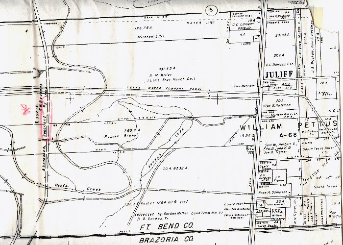
Juliff is in the William Albert Pettus League
Russell Brown was an architect in Houston. He established the first sucessful subdivision, Southampton, near Rice Stadium.
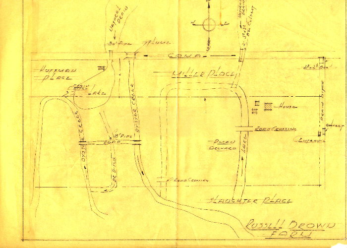
The following sketch shows the rice canal established in 1935 but does not show Miller Rd next to the canal.
MONTE VISTA HISTORIC DISTRICT. The "Gilded Age" in San Antonio (1890-1930) produced several opulent suburbs-Government Hill, West End, Alamo Heights, Tobin Hill, Laurel Heights, and Monte Vista. The last surviving neighborhood of this era, known since 1975 as the Monte Vista Historic District, is bounded by San Pedro, Hildebrand, Stadium Drive, and McCullough from Huisache south to Ashby. The Monte Vista district is one of the few remaining neighborhoods in Texas built for the most part in the prosperous years 1890-1930, which has not been ravaged by demolition, fires, and landlords. British, New England, and Denver capital produced this residential building era, and the Laurel Heights story begins with Jay Adams, a Denver promoter. Even as Adams urged would-be site owners-"Take the San Pedro cars and do not stop until you get to the end of the line"-financier E. B. Chandler and Texas jurist Leroy G. Denman had already built magnificent homes on rock foundations in French Place. Leading architects Alfred Giles and Harvey Young provided community leaders T. H. Franklin, Mrs. E. A. Stribling, Frank C. Davis, Floyd McGown, G. Bedell Moore, Alfred S. Gage, Michael Goggan, and David St. Clair Combs homes of distinction in the neighborhood by 1910. The artists Julian and Eleanor R. Onderdonk also grew up there in a modest framed cottage that their grandfather built in 1882.
Belknap Place, named for the founder of the first successful streetcar system, featured grand homes including that of Adams. Architect James Riely Gordon, who shortly thereafter designed the Romanesque Bexar County Courthouse, drew the plans for this singular four-story residence, which yet attracts visiting architects. At the corner of Belknap and French stands one of the finest examples of Atlee B. Ayres's architecture. Of strong symmetrical composition and handsome brick detailing, this eclectic residence and carriage house built for cotton broker Roy Hearne was the property of oilman Sam Kone from 1922 to 1980.
F. Maury Maverick resided at 127 West Woodlawn at the time of his death. He coined the term "gobbledy-gook" and deserves credit for the restoration of La Villita and the establishment of the river walk in this city. The most distinctive residential structure of the pre-World War I era in San Antonio was the Renaissance Revival mansion designed by architect H. A. Reuter for cattle baron Herbert L. Kokernot at 114 East Kings Highway. Built in 1913, it later served for many years as the Archbishop's Palace. Kokernot engaged Houston architect Russell Brown to design the home at 115 East Lynwood in 1927. Subsequently it became the home of the late mayor J. Edwin Kuykendall and of Mr. and Mrs. Gus Van Steenberg. Mrs. Van Steenberg was the first president of the Monte Vista Historical Association.
Monte Vista, north of Elsmere, represented primarily the efforts of architect-builders Frost Carvel and Robert McGarraugh. Perhaps the most magnificent homes on Bushnell Avenue included those of Charles A. Schreiner (occupied until 1981 by William L. Moody III) and oilman Marrs McLean. Block residents have included the late mayor Walter McAllister, albeit in a more contemporary home. The eight-story Bushnell Apartments, designed by architect Robert Kelly, housed distinguished San Antonio citizens for half a century. Across the street philanthropist Harry Landa moved into his palatial Mediterranean home in 1929. Another mansion across the way on the corner of Shook and Oakmont Court was that of the Julius Seligman family.
The neighborhood was threatened by commercial intrusion and deterioration in 1973, and the Monte Vista Historical Association was formed. More than 1,600 adult residents signed petitions that led to its designation by the San Antonio City Council as a historic district on July 17, 1975. The charter from the state set forth the association's purposes: "to encourage the preservation of the distinctive heritage of the Monte Vista area; to keep the physical identity of this late nineteenth-early twentieth century district intact; to educate the public, especially the youth, with the knowledge of our inherited neighborhood values which contribute to a wholesome urban environment."
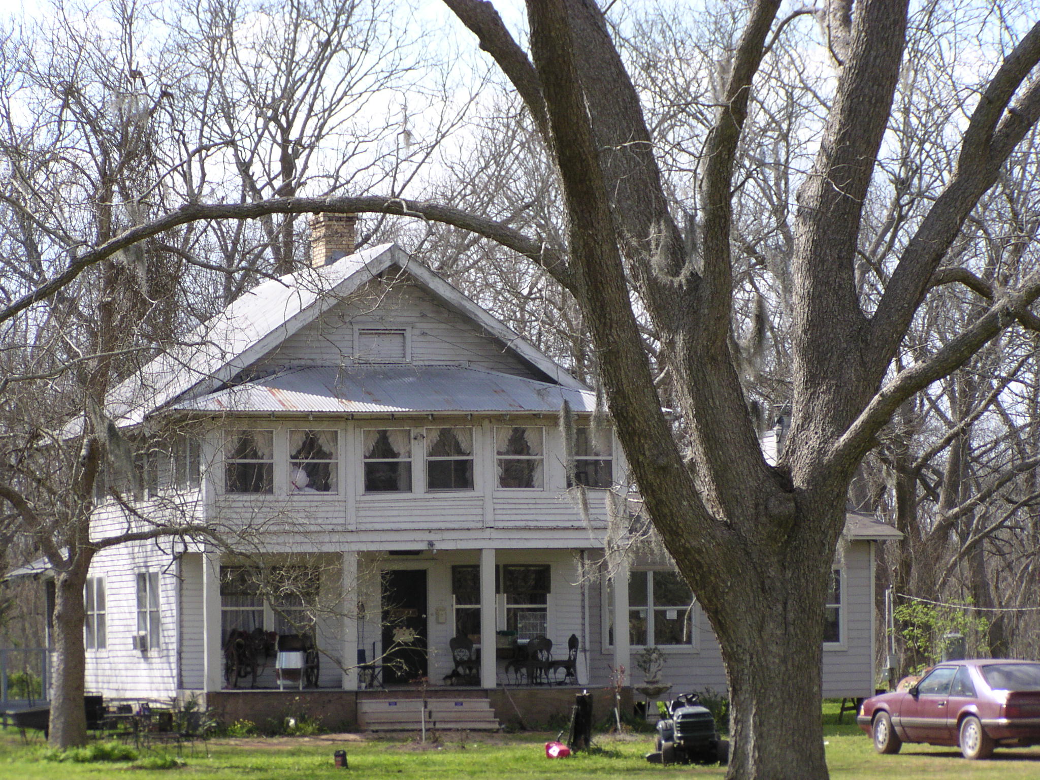
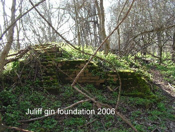
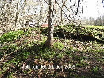
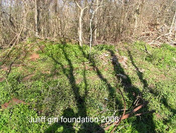
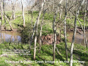
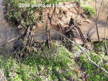
Across the canal from the Russel Brown property is the rest of the Miller property. Here is one of the oldest houses still standing in the area. It was built in the late 1890's. To the west or behind the house is a large pecan tree orchard. To the east or front of the house is the Sugarland Railroad and across the railroad is the foundation of the Juliff cotton gin. The Juliff cotton gin and the road crossing Oyster Creek are on the 1890 map. The Sugarland Railroad wasn't funded until 1893 so it's not on the 1890 map.
The Tigner's Family History and Property

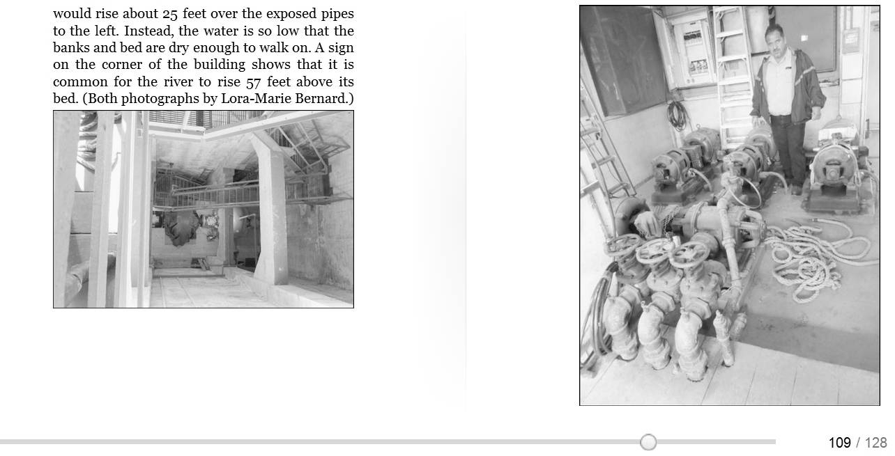
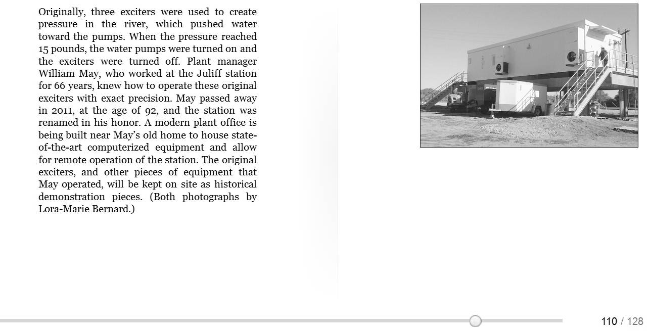
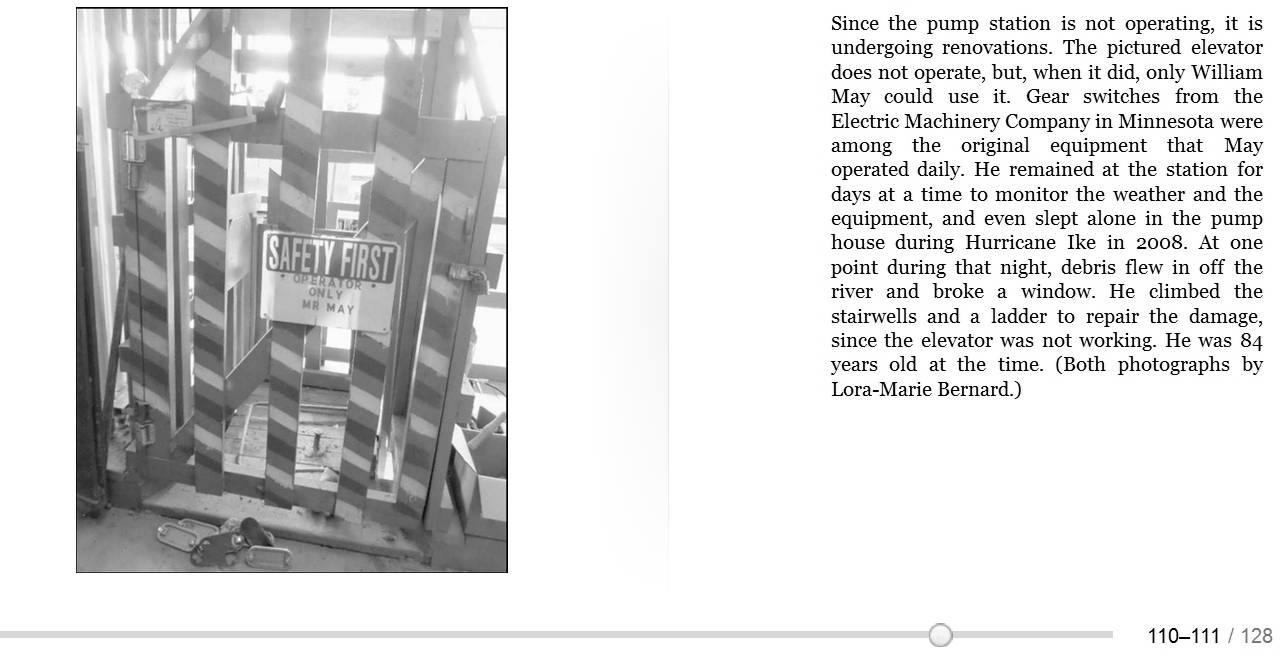
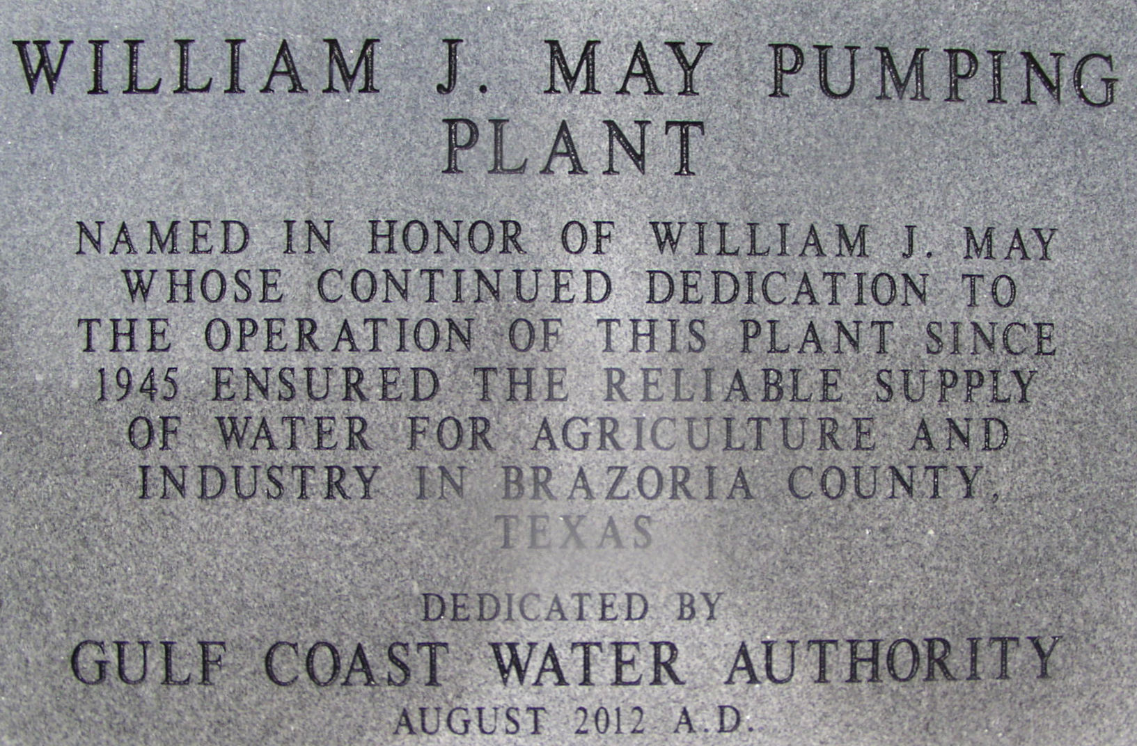
William J. May at the Juliff Pump Station 2006
Mr. May has spent the last 67years on the pump station at the third canal, which runs alongside Miller Road. He started working for the South Texas Water Co. on his 25th birthday, November 6, 1935. A clean-cut, calm, soft-spoken man who is tough as nails. His first year on the job he pulled a seven-foot alligator out of the canal by himself while two friends watched. �Sold the hide for $1.25 a foot,� he says.
Now May is older, he has faced tougher battles. Last year, he missed 22 days of work during which time he had a prostrate operation, a ruptured appendix, and a three-way bypass operation after having a heart attack.
When his appendix ruptured he thought it was just another hernia and waited three days before going to the doctor. He almost died that time. Just a few months later, May passed out so his grandson took him to the doctor. He passed out again walking across the street. The doctor put him on a treadmill and he passed out again. Then the doctor wanted to call an ambulance and rush him to the hospital, instead May had his grandson drive him. On the way he stopped and got a haircut. �If I�m going to die, I�d just as soon die in a barber chair as in a hospital,� May said.
Four days after his three-way bypass surgery, May was back at work at the pump station, which overlooks the Brazos River. The six pumps underneath the pump station can drain 325,000 gallons of water a minute out of the river forcing the water into 303 miles of canals serving rice farmers in Brazoria County. The 900 horsepower synchronizing motors use 2400 AC volts and 125 DC volts to turn 300 RPM to operate the 48-inch double centrifugal Dayton Dowd pumps.
Before he pumps the water out of the river, May orders so many gallons of water from a dam upstream above Waco, Lake Whitney, which is controlled by the Brazos River Authority. It takes about four days for the water to reach the pump station. When the river is very low , he might have to order water from the Possom Kingdom Dam. The water they release takes about three weeks to get to the canal at Julliff. May has witnessed the river almost dry during the five years of drought in the early 1950�s followed by a flood in June of 1957. For several days, May could travel the 3.7 miles from the pump station to Hwy. 521 in a motorboat.
In spite of piers near the pump station to keep the river from cutting out the bank, the Brazos has wiped away 80 foot of land. The piers help by catching fallen trees floating down the river, which could rip out even more soil. During one flood, the piers were covered with a tugboat trying to push a barge upstream that got hung up on the piers, which at that time were under water. HL&P was building a railroad bridge over the Brazos at Thompson where the barge was needed.
Other than the hum of the motors, life is very peaceful and quiet except for the occasional scream of a black panther. The deer, raccoons, bobcats, snakes and buzzards seldom make a sound. From the station, May can look across the river and watch beavers cut a tree so it falls precisely where they want it to fall to build their home under the station. He sometimes sees an alligator sunning itself on the west bank. One good reason for keeping the grass mowed around the station and his house. The purple post at the entrance of pump station is an internationally known symbol meaning no trespassing. It might keep human intruders out, but the various critters go where they want to and May wants to be able to see them before they see him so he keeps about five acres looking like a park. May gets around as good as some men half his age, but he has no desire to wrestle another gator.
August 2012
Condolences
William May 93, passed away January 24,
2013 at his home after spending a week in bed with the flu. May had
spent the last 67 years in charge of the pumping station on the Brazos
river south of Arcola. His services will be held January 30th at Froberg
Funeral in Alvin. He will be buried beside his wife at the Fresno
Cemetery. May is survived by a son and several grandchildren.